Executive Summary
Oshen's 1m C-Star ran singlebeam bathymetry transects off Cat Island for the US Navy's CNMOC, holding station to reconstruct tidal curves in currents stronger than forecast. For survey managers weighing micro-USVs against crewed launches, the binding constraint is not whether the platform survives the sea state but whether the data stays inside an IHO S-44 order. We separate the operability envelope from the data-acceptance envelope and give concrete rules for planning around motion, sound velocity, datum and coverage.
On this page10 sections
- What Oshen’s Cat Island trial actually showed
- The sea-state envelope is two envelopes, not one
- What decides whether the soundings are chartable
- Where planners get the small-platform decision wrong
- 1. Buying the operability number and specifying to the data number
- 2. Specifying singlebeam where the requirement is really object detection
- 3. Treating the reconstructed tide as a datum
- 4. Underestimating sound velocity in exactly the water you deployed for
- 5. Ignoring the current-versus-thrust budget
- How to decide and how to write the plan
What Oshen’s Cat Island trial actually showed
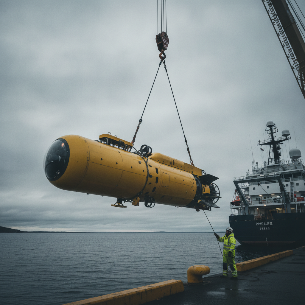
Oshen ran its 1m self-sailing C-Star through two weeks of demanding conditions off Cat Island, Mississippi, in a trial with the US Navy’s Commander, Naval Meteorology and Oceanography Command (CNMOC). The vessel in the water, C-Star PD1, ran multiple bathymetric transects across the Cat Island Channel and ferry lane using a singlebeam echosounder slung beneath the keel. It mapped a sloped seabed and a dredged channel, and – while holding station – logged depth data that CNMOC used to reconstruct tidal curves, one of their stated requirements. The platform was also exercised on manoeuvrability: switching between waypoint and heading control and running slow zig-zag search patterns aimed at future search-and-rescue work. Currents ran stronger than forecast during the transects.
Dr Stacy Johnson, lead scientist at the Naval Oceanographic Office (NAVO), framed the driver plainly: surveying littoral and shallow-water zones is “critical to our operational readiness, but it presents unique environmental challenges.” The wider pitch is rapid seabed mapping after storms – typhoons and hurricanes shift sand, dislodge wrecks and change channel depths, and traditional survey vessels are scarce and slow to mobilise. Fitted with the same singlebeam sounder, C-Stars can work to depths of around 80 metres, are solar- and wind-powered, and can stay out for months. Oshen positions them for standby in storm-prone regions such as the Philippines, the Caribbean and the Bay of Bengal.
That is a genuine capability demonstration. The question for anyone planning surveys is narrower and more useful than “does it work”: under what conditions does a 1m sailing platform produce data you can put your name to, and where does the sea state quietly move it from a survey tool to a reconnaissance tool.
The sea-state envelope is two envelopes, not one
Vendors quote a single operating sea state. Survey planning needs two numbers, and confusing them is the most expensive mistake on this class of platform.
The first is the operability envelope: the significant wave height and current at which the vehicle stays afloat, holds heading, keeps the transducer wet and returns home. For a wind-and-solar micro-USV this is genuinely wide, because a small, well-found sailing hull rides waves rather than fighting them and has no crew to fatigue. The Cat Island work in demanding conditions is evidence of that envelope.
The second is the data-acceptance envelope: the sea state beyond which the total vertical uncertainty (TVU) and total horizontal uncertainty (THU) of the soundings exceed the IHO S-44 order you are contracted to deliver. This envelope is always tighter, often much tighter, and it is set by motion, not by seaworthiness. A platform can be perfectly happy in conditions that make its soundings unusable.
The gap between the two matters because a client reads “operated in rough water” and hears “surveyed in rough water”. Those are different claims. The engineering reason is straightforward: a 1m hull has a short natural period and large angular accelerations in a seaway. Roll and pitch swing the transducer off vertical; heave moves it up and down through the water column. On a singlebeam, both effects feed directly into the depth. The vehicle does not need to be in danger for the data to fall out of specification.
What decides whether the soundings are chartable
Five parameters govern the data-acceptance envelope, and none of them is the hull.
Motion compensation. A singlebeam measures the range along the transducer’s pointing axis. Roll or pitch of angle θ turns that range into a slant range, biasing depth by roughly d(1 − cos θ) on flat ground and much more on a slope, because an off-vertical beam lands somewhere other than beneath the vehicle. Heave adds directly to the measured depth unless removed. The only defence is an inertial motion reference unit co-located with the transducer, logging attitude and heave per ping, with a heave accuracy you can state and hold the vendor to – a figure any survey-grade MRU carries in its specification. On a 1m platform the lever arms are small, which helps, but the angular rates are high, which hurts. The MRU specification, not the wave height, is what sets the top of your data-acceptance envelope.
Sound velocity. Singlebeam depth is the measured two-way travel time times half the sound speed. In post-storm coastal water this is the sleeper error. River discharge and rainfall drop a freshwater lens over saline water, and a 20–30 m/s error in assumed sound speed is roughly a 1.3–2% depth error – half a metre in 30 m of water, enough to blow through an S-44 order 1a budget on its own. A drifting SVP structure is exactly the environment these platforms are sold into. Either a sound-speed sensor at the transducer face or a disciplined cast schedule is not optional here.
Vertical datum and tide. Reconstructing a tidal curve from station-keeping depth data is a neat piece of work and a valid cross-check, but it is a measurement of water-level change, not a tie to a chart datum. To reduce soundings to LAT, MSL or a survey datum you still need a separation model – VDatum in US waters, or an equivalent geoid-to-chart-datum surface elsewhere – or a co-tidal model and a benchmark. The modern route on an autonomous platform is ellipsoidally referenced surveying: PPK GNSS gives the transducer height above the ellipsoid, and the separation model does the rest, removing the need to model tide at all. That depends on a clean GNSS solution from an antenna sitting close to the waterline on a small hull, which brings its own multipath and momentary-submergence problems.
Positioning and heading. THU is driven by the GNSS solution, the antenna-to-transducer offset and the heading accuracy. On a 1m platform the offsets are small, so heading error matters less than on a launch, but a low-cost magnetic heading source in a seaway will still smear the position and the along-track sounding geometry. For context, S-44 order 1a allows a horizontal uncertainty that scales modestly with depth, while special order is tighter still. Neither is hard to meet with survey-grade GNSS, but both are easy to miss with consumer-grade sensors run open-loop over the horizon.
Coverage – the honest limit. This is where the platform’s role is defined. A singlebeam collects a line of soundings, not a surface. IHO S-44 feature-detection requirements for order 1a and special order both assume full seafloor search – complete coverage from multibeam or side-scan with bathymetry – precisely so that a small cubic obstruction between the lines is not missed. The detection sizes differ by order: special order looks for cubic features larger than 1 m, while order 1a looks for cubic features larger than 2 m in depths to 40 m, scaling with depth beyond that. A singlebeam grid cannot make that guarantee, however tight the line spacing. The post-storm use case is where this limitation bites hardest. The very hazards that close a port – a dropped container, a displaced wreck, a fresh shoal crest – are the objects a line survey is most likely to step over.
Where planners get the small-platform decision wrong
1. Buying the operability number and specifying to the data number
The recurring error is contracting an S-44 order against a platform whose data-acceptance envelope has never been characterised. Ask the vendor for the sea state at which residual TVU after motion compensation still meets your target order, not the sea state at which the vehicle comes home. If they can only give you the second number, you are buying a reconnaissance tool and writing a survey specification against it.
2. Specifying singlebeam where the requirement is really object detection
Clearing a storm-hit channel for relief shipping is an obstruction-detection problem before it is a depth problem. A master needs to know the least depth over any hazard in the fairway, not the average slope. Singlebeam answers the wrong question. Where safe-passage assurance is the deliverable, the line survey is a first look that must be backed by side-scan or a multibeam pass – either from a second, sensor-appropriate platform or a follow-up mobilisation.
3. Treating the reconstructed tide as a datum
The Cat Island tidal reconstruction is impressive engineering and it risks being over-read as “no shore gauge needed”. It gives you the shape of the tide at a point. It does not give you the offset to chart datum, and it carries the platform’s own long-period vertical drift inside it. Use it to validate, not to reduce.
4. Underestimating sound velocity in exactly the water you deployed for
Storm-response deployment and worst-case SVP conditions are the same event. Freshwater plumes, sediment load and thermal stratification all arrive with the storm. A platform stationed for months and launched on demand needs an SVP strategy that survives without a support vessel dropping casts – realistically a sound-speed sensor at the transducer, with the residual error carried explicitly in the uncertainty budget.
5. Ignoring the current-versus-thrust budget
A sailing micro-USV has modest speed made good and limited authority against current. The Cat Island currents ran stronger than forecast, which is the normal state of affairs in a post-storm estuary. When current exceeds a meaningful fraction of the platform’s speed, cross-track error grows, line-keeping degrades and planned coverage opens up. Line plans drawn against forecast current, not measured current, will under-deliver. The economics of remote acquisition only close if the platform actually holds its lines, a point we develop in our analysis of when remote bathymetry pays for itself.
How to decide and how to write the plan
Match the platform to the brief with these tests, all of which a survey manager can apply before mobilisation.
-
Split the envelope in the survey plan. State an operability Hs (platform limit) and a separate data-acceptance Hs derived from the MRU heave/attitude specification and the residual after compensation. Stop logging chartable data above the second number even when the platform keeps working. Make both numbers contractual.
-
Fix the target order and test the platform against it, not the reverse. For reconnaissance and change detection, IHO S-44 order 2 or a stated CATZOC-equivalent is honest. For anything feeding a navigational chart in a fairway, order 1a with feature detection is the yardstick, and a singlebeam platform will not reach it alone. Say so in the deliverable.
-
Specify the sensor stack explicitly. Survey-grade MRU co-located with the transducer, heave accuracy stated; sound-speed sensor at the transducer face plus a cast schedule that increases in stratified or post-storm water; PPK-capable GNSS and an ellipsoidally referenced workflow with a named separation model rather than reliance on reconstructed tide.
-
Plan coverage against the hazard, not the depth. Where object detection drives the job, pair the singlebeam line work with side-scan or a multibeam follow-up and record the coverage caveat on the chart. Never let a line survey stand as a clearance survey.
-
Plan line geometry against measured current. Build in a speed-made-good margin, check that thrust and sail authority hold the line in the current actually present, and accept reduced coverage in strong flow rather than pretending the plan survives.
-
Right-size the fleet decision. A 1m sailing platform is a reconnaissance and monitoring asset with long dwell and tiny logistics – genuinely valuable for standby in storm-prone regions and for change detection between full surveys. It is not a drop-in replacement for a crewed launch or a larger, sensor-rich USV. The trade-offs around multi-week autonomous operation are the same ones larger operators are already working through, which we cover in our reality check on multi-day offshore USV work.
The Cat Island trial proved the platform can go where survey vessels are slow to reach and stay there. That is real, and for post-storm reconnaissance and tidal work it changes what is affordable. The discipline is in the specification: buy it for the survey it can defend, characterise the data-acceptance envelope before you contract to an order, and keep the coverage caveat visible all the way to the deliverable.
Based on: Oshen’s robot boats offer rapid seabed mapping for storm-hit ports
Published by
Hydrographic Methods Committee
Bathymetry, Multibeam & Seabed Mapping
An independent review committee focused on hydrographic survey methodology, IHO standards interpretation, and seabed mapping best practices for offshore and coastal projects.
Read next
When autonomous systems make sense: the economics of remote bathymetry
Remote bathymetry economics: when uncrewed survey platforms beat crewed vessels on mobilisation, weather and accuracy trade-offs for basin-scale mapping.
Buy the AUV or the capability? The HUGIN Superior question
Norway's HUGIN Superior brings deep-sea AUV mapping in-house. We unpack the navigation, bathymetry and assurance decisions owners face at 6,000 m and high latitude.

Dual-role PSVs: when your supply vessel becomes a subsea worksite
Why operators install ROV and diving spreads on chartered PSVs instead of hiring dedicated subsea vessels – and the Bridging Document most get wrong.
Offshore Geomatics Foundation Certificate · October 2026
Turn reading into certified competence
Decisions like this one are easier to defend when the fundamentals behind them are certified, not assumed.
Early-access list gets 40% off at launch. No spam – the waitlist is only ever used for the certificate. What the certificate covers →