Executive Summary
Van Oord's VO:X Barentsz completed a multi-day autonomous survey at Ecowende's Hollandse Kust West wind farm, working alongside installation vessels during active construction. The milestone moves purpose-built offshore USVs from coastal trials towards genuine offshore integration. But the industry's enthusiasm for multi-week endurance and lower-cost claims overlooks harder questions: who is accountable when positioning drifts overnight, how do you validate data quality without a surveyor onboard, and what happens when weather stands down the support vessel while the USV keeps running.
A Purpose-Built Offshore USV At An Active Wind Farm
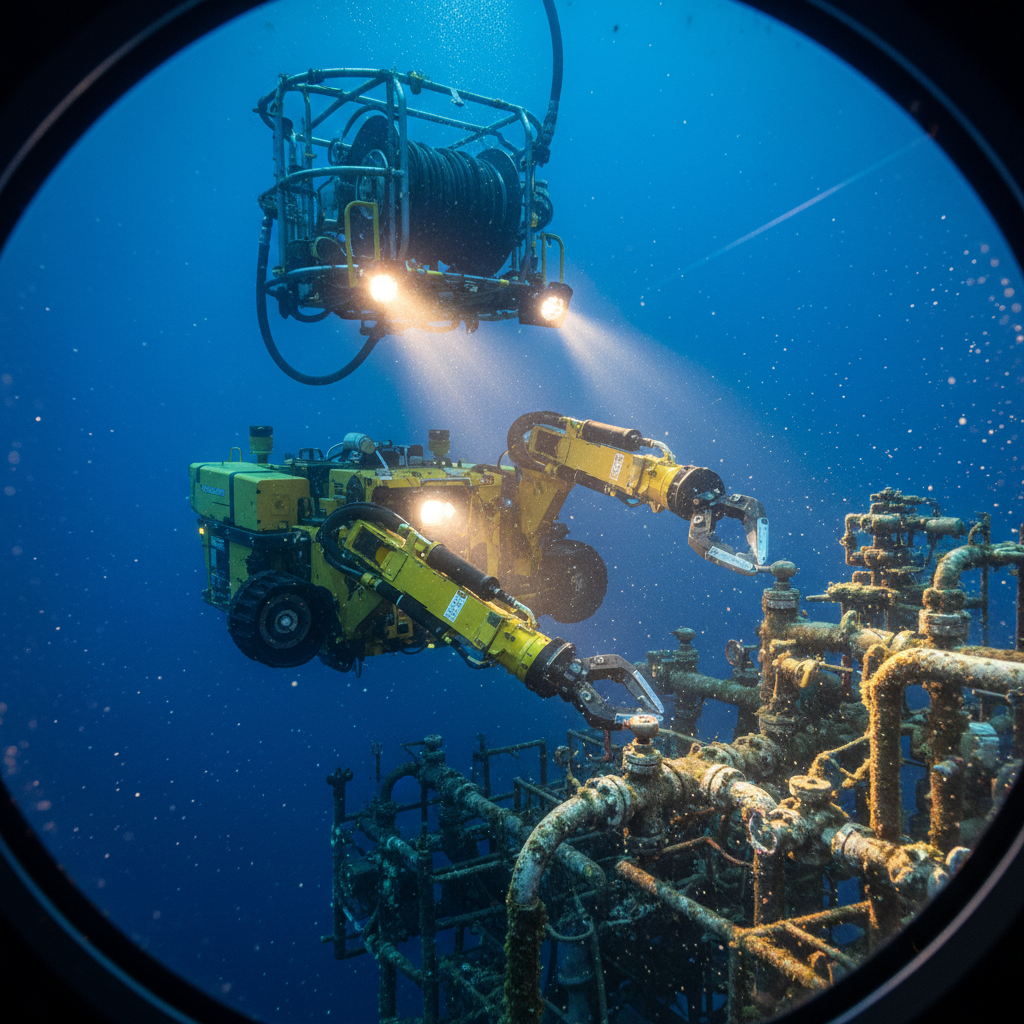
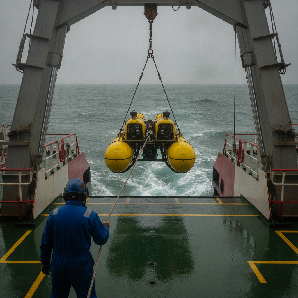
Van Oord’s unmanned survey vessel VO:X Barentsz has completed a multi-day autonomous survey at Ecowende’s Hollandse Kust West wind farm in the Dutch North Sea. It operated alongside the installation vessels Boreas, Nexus and Subsea Viking, which were carrying out monopile and cable installation. According to Van Oord, this is the first multi-day deployment of a purpose-built offshore USV at an active wind farm construction site.
The VO:X Barentsz is the fifth unmanned survey vessel in Van Oord’s fleet and the first designed for open-sea operations. Developed with Demcon Unmanned Systems, it builds on the same platform as the company’s earlier coastal USVs, with added capability for offshore conditions. Van Oord states the vessel is capable of sustained survey activity lasting several weeks. John van der Marel, USV lead at Van Oord, said the deployment demonstrated how unmanned survey vessels “can operate remotely over multiple days, delivering high-quality data while continuing to advance innovation in offshore surveying.”
That is a genuine step. It also leaves the operationally important questions unanswered: endurance is not the same as availability, and “remote” is not the same as “unsupervised.” Below is our read on where the value is real and where the marketing outruns the evidence.
Why This Matters
Wind-farm installation runs to tight weather windows, and survey data sits on the critical path: monopile as-installed position, scour and seabed change, and pre-lay and as-laid cable survey all gate the next installation step. If construction crews do not trust the data, the survey stops adding value and starts costing schedule. That is the test a USV has to pass here, and it is a harder one than coastal bathymetry, where USVs are already well established.
Offshore is not a long coastal shift. Weather, traffic and communications all change at range, so a USV working unattended in the North Sea for several days solves a different problem than an eight-hour shift near port. The supporting model – positioning redundancy, data assurance, remote supervision – has to change with it. And the multi-week endurance Van Oord cites is a capability claim, not the metric that decides a campaign; that metric is availability, addressed below.
The Failure Modes Coastal Trials Never Exercise
Multi-day offshore USV operations introduce failure modes that coastal trials do not exercise.
Start with positioning. GNSS is excellent when it works. Multipath near large installation vessels, atmospheric delay as fronts cross the North Sea, and changing satellite geometry all degrade accuracy. A crewed survey vessel manages this with redundant aiding, line adjustments, or a weather break decided in the moment. An unattended USV needs either genuine sensor redundancy and sound onboard decision logic, or it risks logging degraded data that goes unnoticed for hours.
Data assurance is harder still. Offshore wind survey is typically specified to IHO S-44 Order 1a, whose maximum total vertical uncertainty follows TVU = √(a² + (b·d)²) at the 95% confidence level, with a = 0.5 m and b = 0.013 (1.3% of depth). At a representative wind-farm depth of 30 m that works out to roughly 0.63 m – the tolerance the contractor has to hold for every sounding, unattended, for days. On a crewed vessel a surveyor watches the echogram in real time, spots a bad sound-velocity profile or a backscatter artefact, and reconfigures lines on the spot. Run remotely and you depend on automated QC and whoever is monitoring the feed – if anyone is. The question is not whether a fault can be detected, but who is positioned to catch it, and how quickly.
Then there is the weather asymmetry. Installation vessels typically stand down around significant wave heights above what their installation tolerances allow; a small USV, with no personnel aboard, can keep working in heavier sea states. That sounds like an advantage, and it can be. But if the installation spread is on weather standby, survey data collected meanwhile may sit unused until work resumes – while the USV still consumes endurance and still demands remote monitoring by staff who would otherwise be off shift. The endurance edge can quietly become a coordination burden.
Communications set the real ceiling. Cellular (4G/5G) coverage extends only a limited distance offshore before satellite links are the only option. VSAT offers usable bandwidth for real-time monitoring but carries latency and cost; Iridium gives global reach with bandwidth too low for full remote control; LEO services such as Starlink Maritime are improving but not yet a settled standard for survey-grade telemetry. So the operative question is not whether the hull can endure three weeks, but whether you can guarantee reliable command, monitoring and data transfer for that whole period – and absorb the latency and cost of doing so.
Where Clients Get It Wrong
1. Assuming Lower Cost Means Better Value
Removing the survey crew lowers day rates but moves cost elsewhere: shore-based monitoring staff, survey management and data processing, robust dual communications, backup positioning, and the spares and power infrastructure to keep an unattended platform running. Insurance for autonomous operations is a further, non-trivial line item where cover exists at all. The cost-benefit case depends on the campaign. For repetitive, stable survey – short cable-route monitoring, for instance – a USV can pay off; for fast, dynamic tasks such as a short-fuse emergency survey, a crewed vessel often saves more time than it costs.
2. Confusing Endurance With Availability
Marketing leads with weeks of autonomy, but operational availability is what matters. Even a high-endurance USV loses time to weather, maintenance and data downloads. Effective on-task hours after those deductions can fall well short of the headline endurance, and a responsive crewed vessel that adapts to conditions in real time can close much of the gap. “Unmanned” also does not mean “unattended”: someone still has to watch the data streams, assess quality and manage the link. Qualified remote-survey operators are not easier to find than experienced offshore survey teams.
3. Overlooking Data Validation Workflows
Construction needs verified, as-built-usable data, and quickly: pile-position confirmation, cable-route survey, scour and seabed assessment to release rock placement. Autonomous collection can lengthen the loop – collect, download, process, QC – and any quality issue that triggers a re-survey lands on a schedule that has no slack. When no surveyor is “behind the sonar,” that delay is felt by the installation spread waiting on approval.
4. Ignoring Liability And Certification Gaps
Who signs off the survey? On a crewed job the lead surveyor accepts the result. Distribute the role across a remote monitor, a processing team and a vehicle operator, and accountability blurs – until a positioning error in a cable survey forces remobilisation. Two contractual levers are within the buyer’s control and worth fixing before mobilisation. First, name a single accepting party for the survey result – a designated party chief or charge surveyor who signs the deliverable, regardless of how the work is distributed across the remote team, so there is one accountable signature rather than a diffuse chain. Second, allocate the cost of re-survey and remobilisation in the contract up front: state explicitly who bears the vessel time and schedule hit when a positioning or data-quality error found in QC forces a line or a site to be re-acquired. Standards are not settled either: classification societies such as Lloyd’s Register and DNV publish guidance, but many USVs lack full maritime certification, and insurance cover for commercial autonomous survey is limited or heavily caveated. Treating certification, the accepting signature and the re-survey cost split as afterthoughts means resolving them under pressure when something goes wrong.
What Actually Determines Success
Reliable hardware is necessary but not sufficient. The platform should meet or exceed the positioning redundancy of a crewed vessel: SBAS-corrected GNSS as primary, RTK as backup where baseline allows, acoustic positioning for work close to structures, and a tactical-grade IMU to ride through GNSS outages rather than fail at the first dropout.
Communications architecture is the foundation, not an accessory. Plan for at least dual-path links – for example cellular with a satellite backup – with enough bandwidth for real-time bathymetry rather than position-only tracking, control latency low enough to act on, and bulk data upload scheduled into weather downtime when bandwidth cost is secondary to schedule.
Define the remote-supervision protocol before mobilisation: who monitors the USV overnight, what triggers immediate intervention versus a next-shift check, who is authorised to change survey parameters or abort, and what is reviewed after processing. Clients who treat these as operational detail tend to discover them during a dispute.
Set the bad-weather procedure explicitly. If the assumption is that USV and support vessel stand down together, you have not planned for asymmetric operations. Define when the USV continues while the support spread waits, how data gathered without the installation crew is handled, and where liability sits if conditions exceed forecast – not a rare event in the North Sea.
The Path Forward
The VO:X Barentsz deployment shows that multi-day offshore USV survey is technically feasible. The harder question is where it adds value rather than complexity. USVs suit planned survey work with stable positioning – cable-route monitoring, construction support in moderate conditions, routine infrastructure inspection – where the plan holds, QC can run to a routine, and clients can tolerate some delay in delivery. For complex work demanding rapid in-field adjustment, operation among dense traffic, or hard deadlines, crewed vessels still hold the edge, because human judgement outperforms autonomy when the plan breaks down.
The gap is data. Long-campaign performance figures are scarce, so do not let a contractor answer with endurance hours. Make the tender demand the metrics that actually decide the job:
- Realised availability, measured as on-task survey hours divided by deployed hours over a full multi-week campaign – not platform endurance, and not a best-day figure.
- Re-run rate: the percentage of survey lines re-acquired because of positioning or data-quality faults, with the underlying cause logged.
- Remote-QC turnaround: elapsed time from data capture to a pass/fail quality decision, benchmarked against a crewed vessel where a surveyor calls it in real time.
- All-in day cost: shore-based monitoring, dual communications, processing, certification and insurance loaded in – not the bare hull day rate.
- Link availability: percentage of deployed time with command-and-monitoring telemetry up, plus the longest blackout endured.
Ask for these as figures from prior campaigns, with references. Without that evidence, clients are buying on promise. Van Oord’s VO:X Barentsz is a real step forward; the next one is not just longer missions or harder conditions, but transparent reporting of what worked, what did not, and where the limits sit. In offshore work, new technology earns its place only by demonstrating that – reliability first, adoption second.
Based on: Van Oord completes first multi-day offshore deployment with VO:X Barentsz
Published by
Unmanned Systems Review Board
ROV, AUV & Autonomous Subsea Systems
A technical review board evaluating ROV and AUV capabilities, autonomous inspection methodologies, and unmanned subsea system integration for survey and construction support.