Executive Summary
The shore approach transition zone – from beach valve to first offshore kilometre – shows the most technically demanding and frequently botched scope in pipeline DOB verification. Operators treat burial depth as a one-time check, apply single survey methods across incompatible environments, and ignore seabed mobility that can expose pipelines within months. We've reviewed standards, field cases from Corrib to Ichthys, and the technical reality of surveying across dry beach, surf zone, and shallow water. The solution requires multi-method surveys, seasonal timing, and monitoring programmes that actually account for how transition zones behave.
The Transition Zone Problem
We have repeatedly observed that checking the depth of burial of pipelines near the coast is completely ineffective. The problem lies neither in physics nor technology. It’s a fundamental misunderstanding by operators about what and when they are actually checking. Near-shore inspection represents a complex transition from the shore to the sea, extending from the beach valve to the first kilometer offshore. This includes land, the intertidal zone, the surf zone, and the nearshore seabed. Each zone requires its own inspection methods and has its own set of potential failure points. And the seabed? It doesn’t simply stand still and wait for the next inspection – it’s constantly changing. Pipelines buried at 2m cover in 2020 may have less than 0.5m cover by 2025 – exposed enough to be snagged by fishing gear or anchor strikes. And we have seen operators – thankfully – point out the need for sub-bottom profiler surveys even when the water depth doesn’t exceed 5m. We’ve also seen DOB programs that use simple interpolation across 200m wide tidal channels and call that “verification.” The standards are clear here. DNV-ST-F101 requires as-built verification of the pipeline and continuous monitoring throughout its operational life under varying conditions. The real issue is that DNV-RP-F107 classifies landing sections as high-risk areas due to high levels of human and shipping activity in the vicinity. And what about NORSOK Y-002? It explicitly requires monitoring the pipeline for five years after installation and then conducting risk-based inspections. Despite this, we keep seeing the same mistakes in different projects. Let’s look at what’s going wrong and how to fix it.
Why Shore Approaches Are Different
Out at sea, conducting seabed surveys for pipelines is relatively straightforward. Work is carried out at depths exceeding 20m. The seabed remains stable for years. A seabed profiler is installed on board the vessel, providing continuous burial profiles with an accuracy of 3m. The timing of the survey depends on the weather, not the tides. Such opportunities are not available near the coast. The horizontal distance from the 10m depth contour to shore typically ranges from 500 to 1500m, depending on the beach gradient. We have already observed tidal ranges of over 8m – for example, at Bladin Point near Darwin during the Ichthys project – and this seabed is subject to considerable change. Wave action, tidal currents, coastal currents, and storms cause almost constant changes to the seabed profiles. bathymetric data from a survey of Langeled beach in Easington confirm this: Seasonal seabed level changes of up to 1.5m have been documented in the first 500m from shore. This beach is located on the supposedly stable east coast of Great Britain. Sand tides can bury and then resurface pipelines annually. Storms can erode up 2m of soil overnight. The risk of non-compliance is extremely high – the UK’s OPRED agency has issued specific safety warnings following reports of inadequate monitoring. Planning must consider the maximum expected erosion over 25 to 40 years – assuming a storm return period of 1 in 100 years. The values in the North Sea? They are 1.0–2.0m below the “stable” seabed in the first kilometer offshore. In northwestern Australia, in cyclone zones, they range from 1.0 to 3.0m. These are not just additional buffer zones – they are the fundamental requirements for keeping pipelines underwater.
The Survey Method Gap
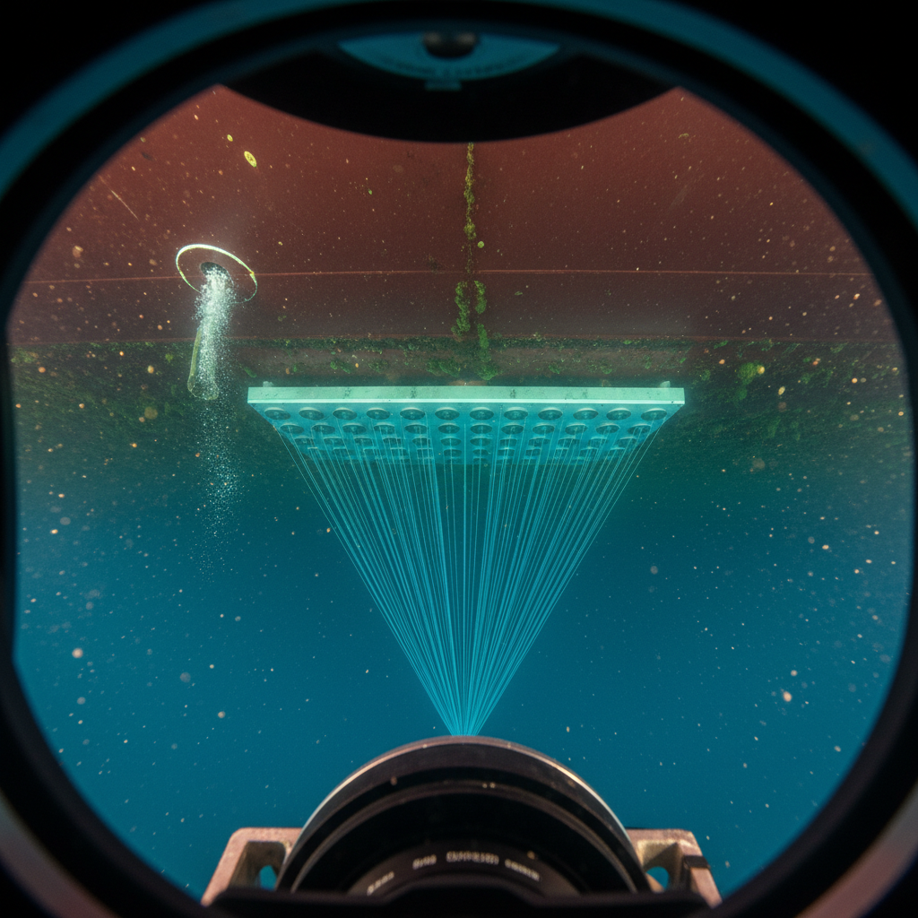
We’ve noticed an unfortunate pattern in most construction regulations: they require only a single method for coastline surveying, usually a seafloor profiler. This approach doesn’t work. Every survey method has its limitations, and these limitations create gaps in coverage. Seafloor profilers? That’s the primary method for offshore work. Systems like the EdgeTech 3100, the Innomar SES-2000, or the Kongsberg GeoPulse generate low-frequency pulses – we’re talking 2–16 kHz systems – and offer the best resolution by penetrating the seabed and being reflected by the buried pipeline. The accuracy is 0.1–0.3m, but they require a minimum water depth of 1.5–2.0m to operate. Below that threshold, your vessel becomes unsafe, and the acoustic system fails. A seafloor profiler is useless on dry beaches or in the intertidal zone. It cannot measure depth through piles of stones, and the gas-saturated sediments in coastal estuaries completely scatter the signal. For land-based work, ground-penetrating radar (GPR) is the appropriate tool. Systems like the GSSI SIR-4000 or Mala ProEx operate in the 100–800 MHz frequency range and offer acceptable accuracy of 0.05–0.15m in dry sand and gravel). However, GPR cannot penetrate saturated clay or saltwater – conductive media absorb electromagnetic waves too rapidly for usable returns. The effective depth is, at best, 2–5m. At the waterline, GPR loses accuracy. Magnetometric measurements are well-suited for detecting the magnetic signature of steel pipelines in shallow water or even on foot in the intertidal zone. However, depth-of-cover accuracy is limited to ±0.5–1.0m at best. This is impossible with small-diameter or non-magnetic pipes, as well as other metal objects. The measurements are distorted, leading to false alarms. For the section from the beach valve to the waterline, electromagnetic pipe detectors are available (Radiodetection RD8200, Vivax-Metrotech vLoc3). They are fast, cost-effective, and ideally suited for pipeline operators. Accuracy is typically ±5–10% of the cover depth – at 2m cover that’s ±0.2m, adequate for screening. At shallow cover (<0.5m), the method becomes unreliable. They cannot be used underwater.
So what do we have? A data gap in the worst possible place. The intertidal zone – between high and low tide – is too shallow for ship-based ground-penetrating radar surveys and too wet for conventional ground-penetrating radar. Moreover, it’s only accessible during short low-tide periods of two to three hours. Most operators don’t even explore this zone or simply estimate where the last point on land and the first point at sea lie. This creates a gap of 50 to 200m in the stratigraphic profile, precisely where seabed movement is greatest and the risk from third-party interference increases dramatically. We must demand that the specifications take these methodological limitations into account and stop pretending that a one-size-fits-all approach is suitable for all surveying work. It isn’t.
What Corrib and Nord Stream Actually Showed
We believe the Corrib pipeline landfall at Glengad is one of the best-documented projects in the history of the European continental shelf. Shell opted for horizontal directional drilling (HDD) below the beach and close to the coast, reaching the surface at a depth of approximately 20m. Onshore, opposite the mouth of Sruwaddacon Bay, long-term environmental monitoring was standard practice. A combination of methods was used to verify compliance with construction standards: sub-bottom profiler (SBP) offshore, ground-penetrating radar (GPR) onshore, and underwater surveys in the transition zone. All of this has been documented here. The most interesting thing about it? The environmental and regulatory oversight of the landfall made the engineering investigation seem like child’s play. The project focused more on meeting the requirements of the environmental monitoring program (public concerns, etc.) than on addressing simple engineering challenges. Nord Stream? That’s a completely different story: two pipelines crossing the Baltic Sea and coming ashore at Portovaya Bay and Lubmin. HDD under the beach in Lubmin? The outlet is at a depth of 18m. The Germans also took the regulations very seriously and required annual inspections of the first two nautical miles off the coast. To check the pipeline depth, they used multibeam, SBP, and visual inspections with an ROV. HDD may seem like a convenient method, as it closes the inspection gap in the intertidal zone – the pipeline remains underwater – but it offers no guarantees. HDD is fraught with risks: deviations from the planned route, inspection of the annular gap (between the pipeline and the borehole wall), and the impossibility of conducting inspections far offshore. It’s possible to discover the underwater position of the pipeline too late, for example, by discovering a geological hazard along the route or by observing the interaction of the outlet section with the seabed. The 890-kilometer Ichthys LNG export pipeline ran from the Browse Basin to Darwin, reached the mainland at Bladin Point, and crossed Darwin Harbour. The challenge was dealing with 8m tides and the risk of cyclones. Imagine having to time the start of offshore work to within ±2 hours of high tide to ensure adequate coverage. The time windows for the SBP survey had to be planned months in advance and coordinated with the tides and seasons. Missing that window meant waiting until the following month.
This operational chaos is completely out of step with the project plan. Inspecting onshore pipeline access points isn’t simply a matter of “building in reserves for bad weather.” Rather, it boils down to: “We might have four days for this this month, and if the weather goes crazy, we’ll see you again next month.” Based on industry case studies and project documentation, this article examines the observed trends in onshore pipeline access.
The Seven Errors That Keep Repeating
Mistake 1: One survey, done. We’ve seen this far too often. The pipeline is laid, as-built survey confirms: “Looks good, the lining is solid.” Five years pass, and – surprise! – a third party discovers an outcrop. The seabed is constantly in motion. A pipeline buried at 2m cover in 2020? By 2025, scour and erosion may have stripped it to 0.3m – or exposed it entirely. UK OPRED has detailed all of this for the British continental shelf. The only sensible approach is: two as-built surveys in the first year over a six-month period, and another during the most unfavorable time of year. From year 2 to 5, conduct annual surveys when conditions are most extreme (after the North Sea winter, after the cyclone season in northwest Australia). From year 6 onwards, use risk-based intervals. We’re talking about periods every 2–3 years in stable areas and annually when the seabed is in motion. If a storm develops outside the calculated area or changes are made nearby, conduct a survey for three months.
Mistake 2: Using a method in unsuitable areas. Who tries to deploy SBP from the shore across the beach? It doesn’t work at depths below 2m. Therefore, the operatorgets no data in the surf zone and the intertidal zone, where the seabed is changing the most. We have a better method: a combined method. Use GPR at 250/400 MHz from the beach valve to the high tide line. At low tide in the intertidal zone, use a magnetometer, with diver probes as a backup. SBP operating at 2–16 kHz works well from 2m to 10m water depth off a small boat, and at greater depths, use a standard SBP mounted on a boat or dive boat. Configure the instrument for the specific zone.
Mistake 3: Wrong time of year. Planning a DOB survey during a quiet summer? Observe how the pipeline is exposed during winter storms and wait until the following year to notice it. In the North Sea, this is a persistent problem – inspections are scheduled, but the timing is unclear. Conduct the inspection during the worst of the season. Are annual inspections legally required? Schedule them for late winter or early spring in the Northern Hemisphere to detect post-storm exposure. In cyclone-prone areas, conduct the inspection 2–3 months after the end of the cyclone season.
Mistake 4: Chaos with vertical reference systems. There is no excuse for this confusion. Changing tidal reference systems mid-survey inevitably leads to problems. One survey uses sea level, the next latitude. Tidal corrections? They are often overlooked in shallow waters, where they are most critical. Vessel draft and sensor drift cannot be ignored either. It gets even worse when a silt line without any definition serves as a depth reference on a constantly changing seabed. For DOB surveys, use only the charted reference system or latitude. Use local tide gauges or RTK GNSS water levels for tidal corrections (not predicted models alone). Specify the vertical reference system, correction methods, and vertical uncertainty in every report. Two landfall reference points linked to the national geodesy system are mandatory and must be referenced in all reports.
Mistake 5: Incorrect positioning in the surf zone. This isn’t just poor positioning – it’s simply incorrect positioning. Imagine you’re measuring a pipeline, but due to unreliable GNSS signals, faulty ship sensors, diver drift, and towfish with SBP instruments in breaking waves, you’re significantly off. You either measure the wrong diameter or completely miss pipeline deviations.
Mistake 6: SBP data is mistakenly interpreted as definitive. SBP shows acoustic reflections, not real objects. Geological strata are mistaken for pipeline tops, pipelines in gas-saturated sediments are overlooked, unfounded assumptions about sound velocities in sediments are made, and the way the pipeline’s acoustic signature changes depending on the cover material is missed. The solution: Every SBP measurement must be validated. At least 3–5 underwater probes or excavation points per survey campaign. SBPs provide the profile; probes ensure calibration and reliability.
Mistake 7: The tidal zone is ignored. The intertidal zone could practically exist on another planet. Too shallow for ship-based surveys, too wet for standard ground-based radar, too exposed for divers – there are only 2–3 hours at low tide for exploration. Most operators simply leave it at that and fill in the gaps. It’s a 200m plunge into the unknown in the most dangerous area.
What do we recommend? Waterproof ground-penetrating radar, such as the GSSI SIR-4000 with marine antenna, at low tide. Divers conduct soundings at low tide when conditions are more stable. Pedestrian magnetometers are used at low tide. For critical pipelines, continuous monitoring of pipeline depth using fiber-optic DTS sensors or, where available, seabed pressure sensors is required – this requires additional effort.
What Standards Actually Require
Sections 5 and 11 of DNV-ST-F101 define the required depth of burial based on risks such as external damage, hydrodynamic stability, thermal insulation, and preventing deformation during updrafts. The standard clearly states that a preliminary as-built assessment and ongoing monitoring are required because conditions can change. All the landfall locations we’re considering fall under the category of “known changes.” DNV-RP-F110 addresses global buckling of pipelines – the risk that a buried pipeline lifts out of its trench under operating temperature and pressure. Minimum cover to prevent upheaval buckling is typically 0.5–1.5m depending on pipe diameter and operating conditions. If your DOB survey shows cover loss approaching that threshold, you have an integrity issue that triggers immediate engineering assessment. Then there’s the DNV RP-F107 standard, which takes a risk-based approach. Landing zones are considered high-risk areas: human activity, shipping, construction. Increased risks mean more frequent monitoring. API RP 1111 specifies a minimum coverage of 0.9m in water depths below 60m. The maximum predicted seabed erosion during the operational lifetime must be taken into account. And regular inspections are mandatory in areas with known seabed instability – so, for every landing. NORSOK Y-002? Quite simply: The landing dredging depth must account for erosion caused by once-in-a-century storms. Additionally, a monitoring program is required for the first five years after installation. The depth of burial must be below the stable seabed, not at the current position. The UK’s Pipeline Works Authorisation (PWA) issued by the OGA is clear: the prescribed depth of burial must be maintained throughout the pipeline’s operational life. If it falls below the minimum, this must be reported. Furthermore, monitoring in the landfall zones must be intensified (usually annually). These are binding rules, not recommendations.
Cost vs Consequence
You’re planning a DOB survey – let’s talk about the costs. In the British North Sea, a campaign costs £60,000. In the Gulf of Mexico, $50,000–$100,000. In northwestern Australia? There, it’s AUD 100,000–$200,000 (thanks, remoteness surcharge). West Africa is expensive too: $80,000–$150,000. Compared to the cost of pipeline repairs in this region – we’re talking repair costs between $5 million and $30 million, depending on the pipeline’s location and size – these survey costs are pocket change. Mobilizing a team to repair a land crossing? You need horizontal drilling rigs, sheet piles, and environmental permits. That takes months: fines, operational problems, and reputational damage from an unreported risk? Those are disastrous consequences. And yet, operators try to save on inspection costs by extending monitoring intervals or skipping field data verification altogether. $100,000 a year for 25 years? That’s just $2.5m. A single repair costs $10 to $20 million and can shut down your pipeline for its entire lifespan.
What Works: The Multi-Method Programme
A well-designed shore approach DOB monitoring programme should look like. Four zones must be carefully covered: Land zone (from the beach valve to the high tide line): Use ground-penetrating radar at 250 or 400 MHz. This provides an accuracy of 0.05–0.15m. Supplement the measurement with an electromagnetic pipe locator for a quick check. Conduct the measurement at low tide when the beach is dry. Intertidal zone (from the high tide line to the low tide line): Conduct a magnetometric survey at low tide. In soft seabed conditions, it is recommended to use a diver at spring low tide. Allow 2–3 hours per low tide cycle. Depending on the pipeline length, this may take several days. Coastal zone (water depth 2–10m): Use an SBP chirp system from a small survey vessel or workboat. Deploy a towed magnetometer as a backup. Timing is critical – ensure there is sufficient water above the pipe, taking into account the tides and your vessel’s draft. RTK GNSS is our primary tool for vessel positioning and water level monitoring. Near the coast (depths below 10m ): Standard, ship-mounted SBP systems, or ROV-mounted systems if more detailed information is required, are sufficient. This zone is the simplest – it sets the quality standard for all subsequent measurements. The results of each survey campaign should include: 1. A continuous burial profile (DOB vs. chain length) along the entire coastline; 2. An overlay with the originally planned minimum depth of cover; 3. A trend analysis not only for the current survey but also for all previous ones; 4. A traffic light system: Green if the depth of cover exceeds the planned minimum depth of cover, Yellow if it is below but within acceptable limits, Red if it is open or below the safety limit. 5. Be sure to conduct bathymetric survey of the entire coastal zone – either multibeam or SBES, depending on the depth and the required level of detail. Depth data is worthless if you don’t know whether erosion or accumulation is taking place.
The Climate Change Variable
Rising sea levels, changing storm patterns, and accelerated coastal erosion are dramatically altering the conditions for pipeline landfall. Forget the original design assumptions. Pipelines built in the 1990s will be exposed in the 2030s to conditions they weren’t designed for. Take the North Sea pipelines, for example: coastal erosion rates have increased dramatically since their installation. A 100-year storm event? Well, not quite – it’s evolving into a 50-year or even a 25-year event. Operator monitoring programmes need updating. If you’re still operating with the original design assumptions, Update your projections with current climate data and updated coastal erosion rates. Did you install a pipeline 20 years ago and haven’t updated your monitoring plan? Then you’re playing with outdated risks. We’re seeing some operators finally wake up and assess the coastal hazards posed by pipeline landfall. What are they doing? The integration of sea-level rise scenarios and improved storm models led to more frequent monitoring and the construction of additional rock walls in areas previously considered to be completely sheltered from the wind and covered by earth.
What We Tell Clients
Shore approach DOB verification is not a single survey – it is a monitoring programme that spans the pipeline’s operational life. In areas with large tidal ranges or cyclone exposure, survey windows are short and must be planned months in advance. Integrate DOB monitoring data into your pipeline integrity management system. If a cover trend shows progressive loss, that is an early warning – address it before a third-party strike or regulatory finding forces your hand. We know the methods for each zone. We know the correct monitoring frequency. We know the failure patterns. Operators who get this right treat DOB monitoring as a pipeline integrity programme, not a one-off survey scope.