Executive Summary
Offshore operators treat the common operating picture (COP) as a screen or a map layer, when the industry's own bodies have already defined it as a platform built on geospatial technology – the georeferenced backbone that lets every party to a crisis act on the same reality, and the work of geomatics. We lay out the concrete functions geomatics performs inside the picture, why a backbone that works silently is so easily overlooked and declined, and what it costs when that gap meets a real oil spill: lost forecast, wrong response geometry, a fragmented command, and regulatory exposure the duty-holder owns. The underlying defect is a misalignment between the team that holds crisis authority and the discipline that holds the spatial capability – and closing it is a leadership act, not an interdepartmental courtesy.
Every offshore operator says it wants a single version of the truth in a crisis. Almost none treats the thing that produces it as a discipline. The common operating picture (COP) – the shared, georeferenced view that lets a vessel, a shore base, an incident commander and a regulator all act on the same reality – gets talked about as a screen, a dashboard, “the map.” It is not the map. It is the spatial backbone underneath the map, and building that backbone is the work of geomatics. The trouble is that a backbone is invisible when it works, and a discipline that is invisible when it works is easy to do without – right up to the moment it is needed and not there.
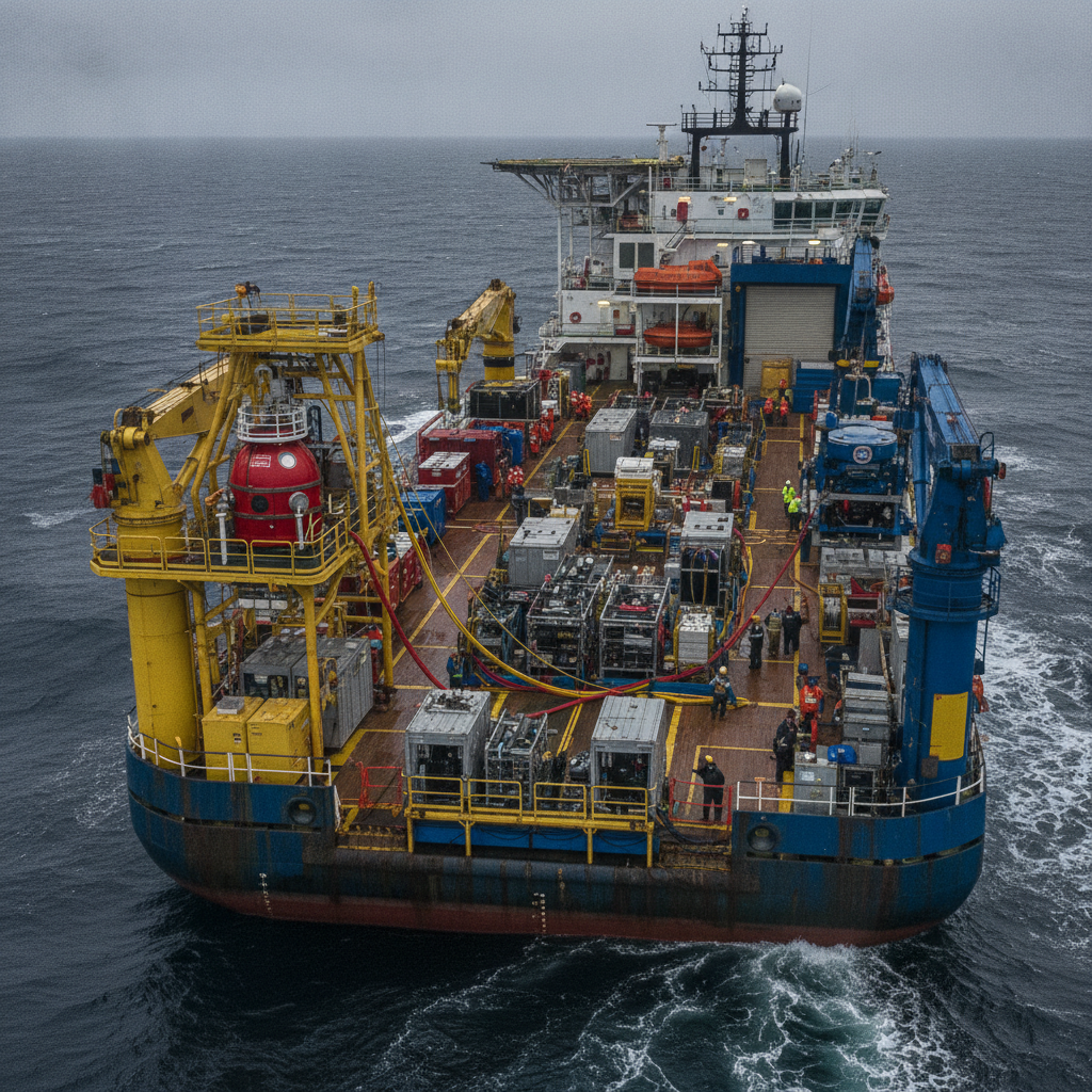
We have watched a particular version of this play out, and it is worth describing plainly, because it is not unique to one company. A geomatics function offers an emergency response team the things that team demonstrably lacks: a common operating picture, georeferenced cartography, live data on a screen, and – specifically – a spill modelling service that forecasts where the oil will go. The response team declines. “We will manage.” And it does manage, in the sense that it has people and procedures. It does not manage in the sense that it has a picture. The distance between those two meanings of the word is exactly the risk the operator is carrying without having decided to carry it.
This piece sets out, deliberately, what geomatics actually does inside a common operating picture, why that role is structurally easy to overlook, and what it costs when the overlooking meets a real spill. It is written for the people who can close the gap – operators’ leadership and emergency-response decision-makers – rather than for the geomatics teams who already know they are being left outside the room.
What a common operating picture actually is – and why “a map layer” is the wrong model
Start with the definition, because the wrong definition is half the problem. A common operating picture is not a display. It is the condition in which every party to an operation is acting on the same georeferenced reality at the same time: the same positions, the same forecast, the same uncertainties, the same sense of what is where. The display is how that condition is shown. It is not the condition itself. You can have an impressive screen and no common operating picture – three teams looking at three different screens – and you can have a genuine common operating picture with very modest displays, because everyone is working from one agreed, correctly georeferenced dataset.
The industry’s own guidance is clear about the ingredients. The IPIECA-IOGP good practice for oil spill preparedness and response describes situational awareness as the product of three things working together: surveillance, predictive modelling, and the depiction and reporting of response data. Read that list again, because each of the three is, at its core, a spatial problem. Surveillance is georeferenced observation. Predictive modelling is the propagation of a substance across a georeferenced surface under georeferenced forcing. Depiction and reporting is the rendering of all of it into one coherent, correctly registered view. “A map layer” is what you call this if you have never had to make the layers agree.
The industry has, in fact, already conceded the central point on paper. IPIECA defines a common operating picture, in as many words, as a platform built on geographic-information-system technology that provides a single source of data for situational awareness. The Open Geospatial Consortium, together with IOGP and IPIECA, went further and published a Recommended Practice for precisely this – an open-standards common operating picture for oil spill response, written in the wake of Deepwater Horizon. So the discipline’s centrality to the picture is not an argument anyone still has to win; it is already on the record. What is missing is not the recognition on paper. It is the recognition in the room.
Laying out the role: what geomatics does inside the picture
So state the role precisely, because “the map guys” hides at least seven distinct functions, every one of which has to be right before the picture can be trusted.
First, the common spatial framework. Everything in the picture – vessels, assets, sensitive shorelines, the modelled slick, the responders – has to sit in one coordinate reference system, on one datum, or it does not overlay. This is the most mundane and the most load-bearing thing geomatics does, and it is invisible precisely because when it is done right nothing looks wrong. When it is done wrong, two correct datasets disagree by a few hundred metres and no one in the room can say which one to believe.
Second, positioning integrity and uncertainty. A position on a screen is a claim, and the claim has a quality. Geomatics is the discipline that knows the difference between a position good to a metre and a position good to a cable – a tenth of a nautical mile – and that carries that uncertainty into the picture instead of letting every dot look equally true. In a response, a confident wrong position is more dangerous than an honestly uncertain one.
Third, interoperability – making heterogeneous data speak. A crisis picture pulls from charts, bathymetry, vessel tracking, survey, met-ocean feeds, sensor outputs and models, each in its own format and frame. Turning that into one picture is precisely the problem that the IHO S-100 universal hydrographic data model and the ISO 19100 series of geographic-information standards – coordinate referencing in 19111, metadata in 19115, services in 19119 – exist to solve. And integration is where data quality lives: the metadata, lineage and fitness-for-use that tell a commander whether a dataset is current, authoritative, and good enough to bet on. A picture with no provenance is a confident guess in the costume of fact. Geomatics is the discipline fluent in all of this; without that fluency, integration is done by hand, late, and wrongly.
Fourth, the base against which everything else is read. Bathymetry, the coastline, the chart – the reference frame against which every moving thing is judged. A slick heading for a shoreline means nothing without the shoreline rendered correctly and its sensitivities attached to it.
Fifth, turning model output into a decision. A spill trajectory model produces time-stamped geospatial fields: where the oil is forecast to be in six, twelve and twenty-four hours, when it makes landfall, where the windows for recovery at sea open and close. Whether that model is run by met-ocean specialists or by geomatics, its output is inert until it is registered into the common picture against receptors and assets, where a commander can actually act on it. The modelling and the picture are one pipeline, and geomatics owns the end of it that turns a forecast into a decision.
Sixth, currency. A picture that is right at 08:00 and not updated is a liability by noon. Keeping it live – registering new observations, re-running the forecast, ageing out the stale – is continuous spatial work, not a product you deliver once and walk away from.
Seventh, and the one most easily forgotten: serving the picture so that it is actually common. A picture on one workstation is not a common operating picture; it becomes common only when it is published and synchronised to every party – vessels, shore base, command, regulator – through open geospatial services such as the OGC web-service and API standards. This sharing layer is exactly what the OGC oil-spill-response Recommended Practice sets out to standardise, and it is the function that earns the picture the word “common.” A backbone no one else can see is not a backbone; it is a private drawing.
None of these seven is “a layer.” Together they are the difference between a shared reality and a shared illusion.
Where the backbone goes invisible
If the role is that fundamental, why is it so easily declined? Because it is infrastructure, and infrastructure earns no attention while it works. A response team that has never operated with a proper common operating picture does not feel its absence as a gap; it feels like normal. You cannot miss a capability you have never had. This is the structural half of the problem, and it is no one’s fault in particular: a backbone that does its job silently trains everyone around it to forget that it is there at all. This is as true on an ordinary operational day as it is in a crisis; the difference is only that on an ordinary day a picture that is slightly wrong costs nothing anyone notices, and in a crisis it can cost everything.
The organisation then reinforces the invisibility. On the org chart, the common operating picture usually lives as someone’s “IT system” or “the mapping tool,” which quietly reframes a discipline as a utility. Budgets treat it as overhead. The emergency-response function, which holds the authority in a crisis, sits in a different part of the house from the geomatics function, which holds the capability – and nothing compels the two to meet before the incident. So when geomatics offers the picture, the offer arrives as an unsolicited service from another department, easy to wave off with “we will manage,” rather than as the thing the response plan should have required in the first place. Structure makes the backbone invisible; the organisation chart keeps it that way.
It is worth being fair to the response team here, because the refusal is not stupidity. A team that holds the authority in a crisis has real reasons to be wary of outside help: command has to be unified, and a picture is a form of control; unvetted data and unfamiliar tools are a liability in a regulated response; and more than one commander has watched a specialist arrive with a beautiful map that answered a question nobody had asked while the clock ran. Declining can feel like protecting the response. The problem is what “we will manage” tends to mean in practice – not a common operating picture but a scatter of ad-hoc tools: a desktop chart, a vendor’s model output mailed over as static images, a map on the wall, none of it registered to a common datum, none of it carrying its uncertainty, none of it shared as one live picture. That is not managing the picture. That is managing without one, and calling the absence a decision.
The spill that proves it: response without a picture
None of this matters until oil is in the water, and then it matters more than almost anything else on the table. Consider what “we will manage” actually means in a real spill run without a common operating picture and without modelling.
The first thing lost is the forecast. Spill modelling tells the responder where the oil will be, not merely where it is, and the gap between those two is the whole game. Oil recoverable at sea becomes, within hours, oil on a shoreline, and the cost of those two states differs by orders of magnitude. A team chasing the visible slick is always behind it; a team with a forecast can pre-position for where it will be and catch the recovery window that closes quietly while no one is watching the clock. Lose the forecast – or let the picture that carries it go stale – and you are reacting to history.
The second thing lost is the geometry. Without a georeferenced picture fusing the drift, the asset positions, the sensitive receptors and the responders, equipment goes to the wrong coordinates. Booms protect a shoreline the oil is not heading for; vessels search a sector it has already left. In an environment where a few hours of drift is kilometres, a picture that is approximately right is operationally wrong.
The third thing lost is the shared part of “shared picture.” The incident commander, the vessels, the shore base and the regulator end up working from different representations, and the response fragments into parallel efforts that overlap in some places and leave gaps in others. The common operating picture exists specifically to prevent this; its absence all but guarantees it.
The response-option decisions degrade too. The industry’s framework for choosing among options – dispersants, recovery at sea, shoreline protection – is the Spill Impact Mitigation Assessment, the successor to net environmental benefit analysis, and at heart it is a spatial weighing of impacts across mapped receptors. Run it without a trustworthy spatial picture and you are weighing impacts you cannot actually see.
Over all of this sits a duty. Under the international convention on oil pollution preparedness, response and co-operation, offshore operators are required to hold oil pollution emergency plans coordinated with the national response system. A response conducted without the situational awareness that the industry’s own good practice defines – surveillance, modelling, depiction – is a response that an investigation will measure against that standard and find wanting. The exposure is not only environmental and reputational; it is regulatory, and it belongs to the duty-holder, not to the response team alone.
Here is the governance finding underneath the whole story: the capability existed, in-house, and the authority to use it sat with a team entitled to decline it. That misalignment – capability in one hand, authority in the other, and nothing obliging them to meet – is the actual defect. The refusal is only its symptom.
What leadership has to own
This is not solved by geomatics asking more politely. It is solved by leadership deciding that the common operating picture is not optional, and three things follow from that decision.
The common operating picture has to be a required artefact of the response organisation – written into the oil pollution emergency plan and the contingency arrangements, not a service a team may accept or decline on the day. The open-standards template already exists; the industry has published a recommended practice for exactly this, so it is a matter of adoption, not invention. If the plan assumes situational awareness, and every modern plan does, then the means of producing it cannot be left to chance or to goodwill.
The discipline that builds the picture has to have standing in the command structure. Geomatics in a response cannot be a phone number someone calls if they remember it; it needs a defined place in the incident management organisation. That place already exists on paper: the incident command system puts a GIS specialist in the situation unit of the planning section – exactly where the picture is built, kept current and fed to the commander. The task is not to invent a seat but to fill it before the incident, with the authority to maintain the picture as a duty rather than a favour.
And the duty-holder has to align authority with capability. Where one part of the organisation holds the response authority and another holds the spatial capability, it is the operator – not either department – that owns the risk of their failing to meet. Closing that gap is a leadership act, not an interdepartmental courtesy.
The common operating picture will go on being invisible while it works; that is the nature of a backbone. The task of leadership is to fund and mandate it anyway, on the strength of what happens when it is not there. The discipline that builds it is not the team with the maps. It is the team that decides whether, on the worst day, everyone is looking at the same truth.