Executive Summary
Woolpert and Chance Maritime's fully uncrewed offshore survey for NOAA off Pensacola, Florida – about 1,391 square nautical miles with no surveyors aboard – is an operational milestone. The harder questions sit in the standards. IHO S-44 assumes a hydrographer oversees acquisition and says nothing about how remote oversight is documented or who certifies compliance. The IMO MASS Code, adopted in May 2026, applies to large cargo ships on a voluntary basis and does not address survey-grade certification. For commercial charting work, that gap is a real liability risk.
What Happened
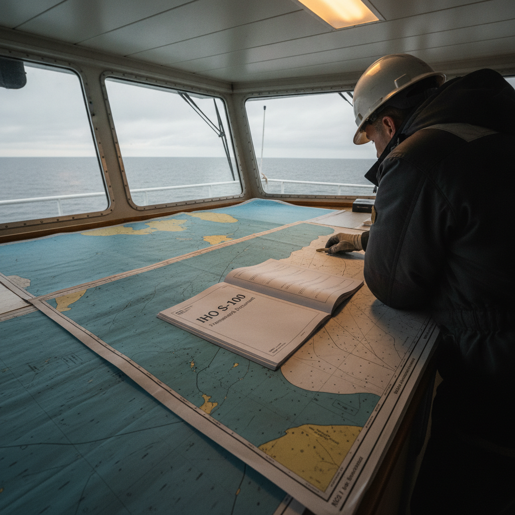
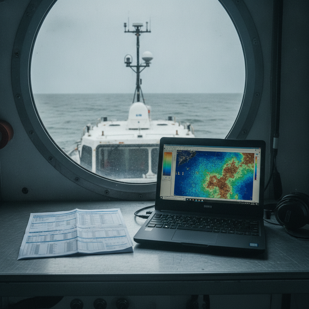
Woolpert and Chance Maritime are running a fully uncrewed offshore hydrographic survey for NOAA off Pensacola, on Florida’s Gulf Coast. Chance Maritime’s uncrewed vessels are mapping roughly 1,391 square nautical miles with multibeam sonar – on the order of 11,000 linear nautical miles over several months – with no crew aboard, hydrographer included. Woolpert’s hydrographers monitor the survey around the clock across time zones. Data moves over Starlink to cloud processing in Woolpert’s Automatic Survey Production Environment (ASPEN), then to shore-based teams for analysis. The stated goals are mapping deep-sea corals, characterising sensitive habitats, identifying seafloor hazards, and updating charting products, with ties to Deepwater Horizon restoration work.
This is not the first survey of its kind for the partnership. In 2025 they ran a hybrid crewed and uncrewed campaign under the Florida Seafloor Mapping Initiative. This time the crewed vessel stays in port.
Why This Matters
The technology works. Uncrewed vessels can acquire high-quality multibeam data, hold predefined lines, and stream results in near real time. The efficiency case is real: round-the-clock operation without the logistics of a crew, and fewer of the failure modes a tired bridge team introduces. That is genuinely useful.
The harder question is certification. Who certifies compliance with IHO S-44 when everyone is ashore? How is calibration validity confirmed when nobody can inspect the installation? Who owns data quality when there is no surveyor on deck to sign for it? These are not hypothetical. S-44 requires documented uncertainty budgets, calibration records, and defined quality metrics, and it is written on the assumption that the hydrographer overseeing acquisition is close to the work. It does not describe how oversight is documented when the surveyor is hundreds of nautical miles away, and it does not define an external certification body for that case.
NOAA’s route is comparatively settled: it contracts to its own published hydrographic specifications, defines the acceptance criteria up front, and is itself the authority that reviews and signs off the deliverables, so the chain from acquisition to accepted data is closed inside one specification. A commercial authority’s acceptance route is less settled precisely because that chain is not closed: the buyer, the certifying surveyor, and the body that ultimately accepts the data for an official chart or a statutory record may be three different parties, working to a certification regime that predates uncrewed acquisition and was written assuming a surveyor on site. For commercial operators following the trend – especially on regulatory charting or safety-critical work – that gap between who acquires, who certifies, and who accepts carries legal exposure.
The Quality-Control Reality
The press materials emphasise data quality and acquisition efficiency. They say less about quality control, which is genuinely harder without a surveyor present.
Routine calibration – latency, roll, pitch and yaw – is normally run on deployment, after any sensor adjustment, and periodically through the survey. On a crewed vessel a hydrographer watches sensor geometry, checks results, and tracks drift as it happens. On an uncrewed vessel those checks are remote. You verify what the telemetry shows and trust that mounting brackets have not shifted, that no new electrical interference has appeared, and that connectors are still seated. You can monitor a great deal remotely. You cannot physically inspect the sonar head or confirm by hand that the inertial measurement unit (IMU) is rigidly mounted. If results look wrong, the vessel has to return to port, which means downtime and cost.
Rejection decisions also change character. Uncrewed operations lean heavily on automated quality control. Depth spikes, bottom-detection failures, excessive motion – software flags the anomalies, but experienced hydrographers judge them in context. Is that acoustic shadow a rock or a processing artefact? Is a data gap real bathymetry or thin bottom coverage? Those calls are harder hours later, working from pixels on a screen with no direct feel for the sea state or vessel motion at the moment of acquisition.
Tide and sound-velocity control raise the same problem. For Order 1a work in dynamic coastal zones, accurate tidal reduction is essential. If a nearby gauge fails or reads oddly, a crewed vessel can switch to a backup or slow down until shore coordination clears it; an uncrewed vessel 50 nautical miles out keeps going until someone catches it in post-processing. Sound-velocity profiles are usually taken at the hydrographer’s judgement – after weather fronts pass, near water-mass boundaries, at intervals set by local variability. Full automation handles steady-state conditions well, but in transition zones or near river discharge it can miss casts, and everything looks fine until overlapping lines reveal systematic depth differences.
Where Clients Get It Wrong
1. Assuming Standards Compliance Is Automatic
Writing “IHO S-44 Order 1a compliant” on a specification does not make it so. Compliance requires documented procedures, calibration, an uncertainty analysis, and a hydrographer accountable for the quality-control requirements being met. If that person never boards the vessel, the question of who stands behind the deliverable becomes a liability question. Some hydrographic offices accept remote monitoring; others want the certifying surveyor present at critical phases – mobilisation, conformance checks, acceptance. On a project with a mandatory charting component, confirm the acceptance route before mobilisation, not after.
2. Underestimating the Remote QC Workload
An uncrewed hull does not remove the hydrographer’s workload; it redistributes it. Instead of one specialist deciding on deck, a skilled shore team processes the data streams and watches quality around the clock. Woolpert staffs across time zones to keep that coverage. This is not cheaper – it is a different cost model. Clients often expect savings from uncrewed work, then find they are paying for continuous shore-based monitoring plus daily vessel use. You are buying speed and persistence, not a lower bill, unless you are working where crewed vessels are genuinely impractical.
3. Ignoring the Certification Gap for Commercial Work
NOAA contracts to its own published hydrographic specifications and runs the deliverables through its own acceptance review, so the route from acquisition to accepted data is well-trodden and the surveyor’s accountability is defined by that contract. Commercial clients – port authorities, offshore operators – are a different matter. Public bodies often require charting updates or as-built documentation to be certified by an approved professional, and some certification regimes are written around direct inspection and verification of the installation. Where a licence or scheme assumes the certifying surveyor has personally examined the system, remote certification can sit uneasily with that wording, because acceptance turns on a condition the uncrewed model does not meet. This is a foreseeable risk rather than a settled precedent: where a scheme assumes direct inspection, it is plausible that an authority declines remotely certified data and the contractor bears the cost of redoing it. Treat that as a risk to price into the tender, not a hypothetical.
4. Overlooking Mobilisation and Acceptance Protocols
Uncrewed does not mean “set sail and go.” Mobilisation for any S-44-compliant survey means acceptance tests, sensor-integration and mounting verification, and baseline calibration – work that is hard to do entirely by remote and that typically needs a hydrographer at the berth. Budget mobilisation time accordingly. The savings from uncrewed operation show up once the lines are being run at sea, not during setup.
What This Means for Certification
The regulatory gap is real and it has two layers. IHO S-44 does not prohibit remote monitoring, but it does not specify how oversight without a surveyor on deck should be documented, and individual hydrographic offices take different views. Some are starting to publish guidance for uncrewed surveys; others are waiting for the IHO to move first.
The IMO side is developing, not absent – and this is where readers may assume the new MASS Code closes the gap. It does not. The IMO adopted its International Code of Safety for Maritime Autonomous Surface Ships (the MASS Code) at MSC 111 in May 2026, with voluntary application from 1 July 2026 ahead of a planned move to mandatory status under SOLAS. But that code is goal-based and technology-neutral, scoped to large, internationally trading cargo ships; it governs the safety of autonomous operation, not survey-grade data certification or who signs off on IHO compliance. So even with a new global instrument in place, the specific question this article is about – how compliance is certified for an uncrewed hydrographic survey – sits outside its scope, and a manager who reads the MASS Code as the answer to the certification question will still be exposed.
Until hydrographic offices fill that space, commercial operators are working in an undefined area. For anything feeding official nautical charts – ENC updates, harbour-approach surveys, cable-route mapping – agree the acceptance criteria with the relevant authority before signing. In particular, clarify:
- Will remotely monitored data be accepted for chart updates at all?
- What documentation is required to demonstrate professional oversight?
- Must the certifying surveyor be present at any stage?
For work outside official charting – site surveys, habitat mapping, internal route assessment – the rules are usually looser, but that is not the same as no liability. Remote oversight is exactly the kind of changed risk a professional-indemnity policy may not have been written to cover, so it is worth confirming with your insurer how they treat it before starting rather than assuming an existing policy carries across.
The Starlink Dependency
The survey relies on Starlink for data transmission, and that is a real single point of dependency. Satellite connectivity is what enables cloud processing and live monitoring, but if the link drops, the vessel keeps recording while shore-based quality control goes dark until it recovers. On crewed vessels, data is logged locally with initial QC on board and regular shore review. Uncrewed platforms carry backup onboard storage, but stored data is not the same as real-time quality control. In areas with reliable coverage and settled weather the risk is manageable. At high latitudes, in known coverage-shadow areas, or during storm season when antenna performance degrades, the dependency becomes a planning constraint. Clients should ask: if the link is down for 12 hours or more, does the vessel keep surveying or hold station, and how is acquisition quality verified after the fact?
What We’d Recommend
Before the recommendations, here is one fragment a buyer can lift straight into an invitation to tender. Adapt it, do not paste it blind – but it turns “agree the acceptance criteria” into something a contractor can actually price:
Certifying-surveyor presence. A named certifying hydrographic surveyor shall be physically present at the mobilisation berth for: (a) sensor-integration and mounting verification; (b) the patch test and any latency, roll, pitch and yaw calibration; and (c) the conformance/acceptance survey over a reference area of known depth before the vessel sails. The same named surveyor shall hold professional accountability for the deliverable. Where any of (a)–(c) is to be conducted remotely, the contractor shall state this in the bid and identify the standard or hydrographic-office guidance under which remote verification is accepted.
A matching acceptance-test list keeps the offer comparable across bidders: patch-test residuals within tolerance; a reference-surface (crossline) comparison against a known or previously surveyed area; sound-velocity casts logged against an agreed minimum frequency and against water-mass boundaries; tidal/vertical-reduction source and backup identified; and a stated total propagated uncertainty (TPU) budget. For depth accuracy, cite the IHO S-44 order explicitly – for example S-44 Order 1a, whose total vertical uncertainty combines a 0.5 m fixed term and a depth-dependent term of 0.013 times depth in quadrature (root-sum-square, not a linear sum) at the 95% confidence level, with full seafloor search – rather than a bare “S-44 compliant”, so every bidder is costing the same accuracy.
For clients considering fully uncrewed surveys:
- Talk to the relevant authority first. If the work feeds official charts or legal requirements, confirm and document the acceptance criteria before signing. Some hydrographic offices accept remotely certified data with specific documentation; others do not.
- Define technical supervision in the contract. State who certifies compliance, which phases require physical presence, and how calibration is documented. Ambiguity here turns into disputes later.
- Plan mobilisation as a crewed phase. Budget surveyor time for installation, testing, and acceptance. The benefit of uncrewed operation is in the survey, not the setup.
- Review your insurance. Confirm that professional indemnity and the contractor’s equipment cover extend to uncrewed operation and remote supervision in your area of work. These gaps surface when something goes wrong, not when the contract is signed.
- Build in communications redundancy. If the mission depends on continuous satellite links, define backup procedures and the maximum time the vessel can survey without shore contact before it must return.
For surveyors certifying uncrewed data:
- Document your verification process. Record how you checked the installation, reviewed calibration, monitored data quality, and validated processing. Any professional-integrity review will turn on that documentation.
- Know your obligations. If your licence or certification expects direct supervision, check whether remote oversight is permitted in your jurisdiction before you sign off.
- Set acceptance criteria up front. Define the quality thresholds that trigger a recall, the calibration checks required, and how you will verify system performance remotely. Put them in the operational plan.
Uncrewed surveys work, and the technology is reliable. The regulatory framework is the part still catching up. That gap raises the risk for anyone certifying compliance without addressing professional oversight. The Woolpert and Chance Maritime survey for NOAA shows operational maturity – but operational maturity is not the same as regulatory clarity for commercial work, and the difference is worth knowing before you tender for it.
Published by
Unmanned Systems Review Board
ROV, AUV & Autonomous Subsea Systems
A technical review board evaluating ROV and AUV capabilities, autonomous inspection methodologies, and unmanned subsea system integration for survey and construction support.