Executive Summary
The Secure World Foundation's 2026 counterspace report records GNSS interference becoming a permanent feature of conflict zones, with ICAO and the ITU formally condemning state-level jamming and 970 ships per day affected in the Strait of Hormuz. For offshore operators, this turns an episodic nuisance into a planning assumption. The binding weakness is not signal loss, which is obvious, but coherent spoofing that defeats nominal position-reference redundancy. We set out the failure chain and concrete safeguards for DP and survey operations entering or transiting affected waters.
What the counterspace report puts on record
The Secure World Foundation’s Global Counterspace Capabilities 2026 describes a year in which GNSS interference stopped being an episodic event and became a standing feature of conflict zones across several continents. As we read it, the shift is documented at two levels: institutional and operational.
On the institutional side, the response has moved into formal channels. In October 2025 the International Civil Aviation Organization passed a resolution condemning GNSS interference originating from Russia and North Korea as violations of the 1944 Convention on International Civil Aviation. The following month the ITU’s Radio Regulations Board, at its 100th meeting, again urged Russia to cease harmful interference to safety services in the Radio Navigation Satellite Service, naming receivers affected in Estonia, Finland, Latvia and Lithuania. The Baltic picture had been building all year. Lithuania coordinated a letter signed by 17 EU transport and digital ministers in June 2025; European Council figures showed aircraft interference cases in Poland rising from 1,908 in October 2024 to 2,732 by January 2025. Estonia reported during 2025 that jamming equipment had been moved closer to its border and attributed significant economic damage to GPS jamming. Sweden’s transport authorities described Baltic interference as occurring almost daily and spreading in both reach and scope.
On the operational side, three conflicts in 2025 show deliberate denial at scale. During Iran’s twelve-day war with Israel in June, Iran jammed GPS over several metropolitan areas to counter drones and missiles, with its Deputy Communications Minister acknowledging the disruption was for military and security purposes. The Maritime Information Cooperation and Awareness centre reported that large numbers of ships were affected in the Strait of Hormuz, with traffic through the strait falling as vessels confined transits to daylight. The report also documents cases where satellite ground terminals had their GPS units spoofed, degrading service until users fell back on internal position estimates and software mitigations were applied. In South Asia, India’s Operation Sindoor in May 2025 saw electronic warfare forces deployed specifically to interfere with GNSS against Pakistani forces.
None of this was aimed at the offshore industry. In our view that is exactly why it matters: offshore operators are bystanders to interference designed for other targets, and the geography of that interference now overlaps heavily used survey, construction and transit corridors.
Why offshore positioning inherits the exposure
The root vulnerability is physical and unavoidable. A GNSS signal arrives at the antenna at around −130 dBm, well below the receiver’s own thermal noise floor, recovered only through correlation gain against a known code. Any terrestrial emitter with line of sight and modest power can raise the noise floor enough to break that correlation. Multi-constellation and multi-frequency configurations raise the power and bandwidth a jammer must commit, but they do not change the underlying asymmetry. A broadband jammer covering L1, L2, L5, E1 and E5 denies all of them at once.
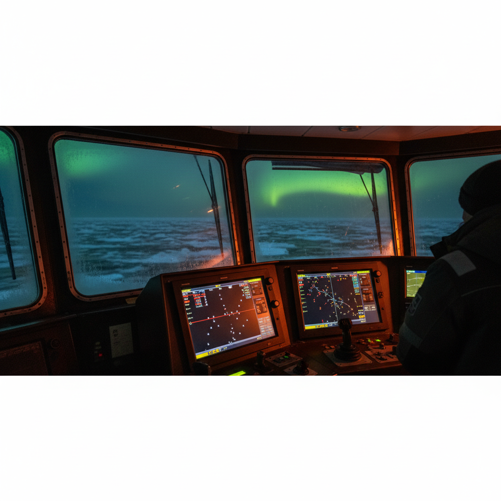
Offshore positioning architecture concentrates this exposure rather than diluting it. Precise GNSS positioning, whether differential, RTK or PPP, is the absolute reference behind dynamic positioning, hydrographic survey, construction metrology and pipelay. The corrections layer improves accuracy; it does nothing for availability when the underlying L-band signals are denied. A vessel holding a tight survey line to IHO S-44 Order 1a tolerances and a DP vessel holding position over a wellhead both depend on the same fragile space-to-ground link.
The deeper problem, in our experience, is correlated failure. IMCA M 103, the guidelines for the design and operation of dynamically positioned vessels, sets the expectation that DP operations carry independent position reference systems, with the long-standing principle that they should not all share the same operating principle. Two DGNSS receivers from different makers, fed by different correction services, look like redundancy on the DP capability plot. Under a jamming event they fail together, because the failure is upstream of both, in the RF environment they share. Nominal redundancy is not the same as diversity against a common-mode threat, and GNSS interference is the textbook common-mode threat.
Shuttle-tanker DARPS arrangements, USBL initialisation that relies on a GNSS surface fix, and survey time-tagging that uses GNSS as the master clock all inherit the same single point of failure. The interference does not need to be persistent to be costly; a few minutes of denial during a critical lift, a close-quarters approach, or a metrology measurement is enough to abort the task.
The detection gap: jamming announces itself, spoofing does not
The two interference modes fail very differently, and we would argue the offshore industry is far better defended against the loud one than the quiet one.
Jamming is conspicuous. Carrier-to-noise density drops sharply, the receiver loses lock, position solutions go invalid, and DP alarms fire. The voting or median logic in a DP system rejects a reference that has gone unhealthy, and the bridge knows immediately something is wrong. The operational consequence is a degraded or aborted operation, which is unwelcome but safe, because the system has correctly identified that it can no longer trust the source.
Spoofing is the harder case. A spoofer transmits structurally valid signals that the receiver accepts as genuine, then walks the solution away from truth. The position remains valid, the integrity flags stay green, and the DP system continues to trust a reference that is now lying to it. Receiver autonomous integrity monitoring was designed to detect a faulty satellite against a consistent constellation, not a coordinated spoofer presenting an internally consistent false picture. Against a capable spoofer, RAIM can be satisfied while the solution is wrong.
The terminal-spoofing cases in the source report are a useful illustration of the principle, even though they concern terminal timing rather than vessel navigation. Spoofed GPS at the terminal corrupted timing badly enough to degrade service, and the fix was to fall back to a position estimate that did not depend on the spoofed signal. The transferable lesson, as we see it, is direct: the asset that can coast on an independent estimate survives; the asset that blindly trusts the L-band fix does not.
The second blind spot is timing. Survey systems use GNSS time, often a one-pulse-per-second signal, to synchronise multibeam pings, sound velocity sampling, motion data and positioning. Time spoofing or time drift under interference corrupts the geometry of the survey without necessarily tripping a position alarm. Data can be logged that looks acceptable in real time and is unusable on review, because the timing that ties soundings to position has been quietly poisoned. Few survey acquisition setups we encounter alarm on time integrity the way they alarm on position validity.
A third gap is instrumentation. Many receivers expose per-satellite carrier-to-noise and automatic gain control telemetry, which together are a sensitive early indicator of both jamming and spoofing. A sudden AGC swing, a uniform C/N0 collapse across satellites, or an abrupt C/N0 rise on signals that should be weak are all signatures worth alarming on. Offshore, this telemetry is frequently available but neither logged nor monitored, so the evidence of interference exists and no one is watching it.
What this changes for survey and DP operations
The planning posture has to change because the threat distribution has changed. Interference is no longer a low-probability event confined to a handful of hotspots; in the Baltic, the Strait of Hormuz, the Red Sea approaches and parts of South Asia it is a standing condition that varies in intensity rather than presence. Any operation we run into or through these corridors should treat degraded GNSS as a planning assumption, not a contingency.
The distinction between safety of navigation and precision positioning matters here. A vessel can navigate adequately through a jammed area on radar, ECDIS dead-reckoning and visual fixes, accepting that it does not know its absolute position to a metre. A survey or DP construction task cannot, because the tolerance budget is tight and the consequences of an undetected error are physical. The same interference that is a nuisance to the bridge can be disqualifying for the back deck.
There is also a data-assurance dimension we keep coming back to. Survey data acquired under interference may meet IHO S-44 accuracy on paper, against a positioning solution that was itself wrong. Without independent cross-checks and logged signal-quality metrics, that contamination is invisible at acquisition and expensive to discover later. The integrity of the position reference becomes a documented part of the survey QC record, not an assumption.
Finally, the institutional moves by ICAO and the ITU signal that this is being treated as a persistent state-level problem, not a transient one. We do not expect the RF environment in these regions to clear quickly, and we plan capability and procedure for a multi-year condition.
Building positioning resilience before the 2026 season
The measures we set out below are specific and testable. We order them roughly from configuration to procedure.
- Run full multi-constellation, multi-frequency. Configure receivers for GPS L1/L2/L5, Galileo E1/E5, GLONASS and BeiDou. This raises the power and bandwidth a jammer must commit and improves availability under partial denial. We treat it as a floor, not a solution; it does nothing against broadband jamming or spoofing.
- Enable Galileo OSNMA where the receiver supports it. Open Service Navigation Message Authentication lets the receiver verify the navigation message is genuine, which directly attacks the spoofing case. Confirm firmware support and turn it on.
- Log and alarm on AGC and per-satellite C/N0. Set thresholds for a uniform C/N0 collapse (jamming signature) and for anomalous C/N0 rise or AGC swing (possible spoofing). Pipe these into both the DP alarm system and the survey QC log so the evidence is captured and watched.
- Hold genuine position-reference-system (PRS) diversity per IMCA M 103. During critical operations in or near interference zones, we keep at least one non-GNSS reference active and weighted: acoustic USBL or LBL, laser systems such as CyScan or Fanbeam, taut wire, or radar-based reference. Two GNSS receivers are not diversity against a common-mode RF threat.
- Specify INS aiding and characterise the coast-through. A FOG-based INS, aided by DVL where water depth allows, lets the vessel coast through a GNSS outage. Establish the drift rate from your trials data and define explicitly how many minutes of denial the operation can absorb before it must abort.
- Protect timing. Provision a disciplined oscillator with adequate hold-over, an OCXO or chip-scale atomic clock, so survey timing survives loss or spoofing of GNSS time. Cross-check GNSS time against the vessel clock and alarm on the divergence.
- Write GNSS interference into the ASOG. Under IMCA M 220, define green, yellow and red thresholds tied to measurable quantities: number of healthy position references, C/N0 drop, and position residual between references. Make the abort criteria objective rather than a judgement call under pressure.
- Test denial in DP trials. Include a simulated GNSS denial scenario in the annual trials programme under IMCA M 190. Verify that the voting logic correctly demotes spoofed and jammed references, that the INS coast performs to specification, and that the crew response matches the ASOG.
- Brief the crew on signatures. Under IMCA M 117 competence expectations, DPOs and surveyors should recognise the difference between a jamming dropout and a spoofing event: a sudden position jump, a time jump, or a C/N0 anomaly with the solution still flagged valid. The quiet failure is the one that needs a trained eye.
- Plan the route on current interference data. Before mobilisation, review NOTAM and NAVAREA warnings and published interference maps for the Baltic, Hormuz and Red Sea corridors. Build the transit and work plan around known affected zones rather than discovering them on site.
In our experience the vessel and the sensors are rarely the limiting factor. The binding constraint is whether the position-reference architecture can detect a lie and continue safely without the source it has lost. Build for that, prove it in trials, and the interference becomes a managed condition rather than a stand-down.
Based on: GNSS Interference Now a Constant of Modern Conflict, SWF Annual Report Finds
Published by
Positioning & Geodesy Working Group
GNSS, INS/IMU & Coordinate Systems
A working group of positioning specialists covering GNSS, inertial navigation, datum transformations, and geodetic network design for marine and land survey operations.